Real Time Construction Progression
You no longer need to be on-site to stay up-to-date with your construction project. Using advanced drone data collection tools, you can remotely monitor progress through high-resolution still imagery, video footage, and interactive comparison tools like Before and After Sliders.
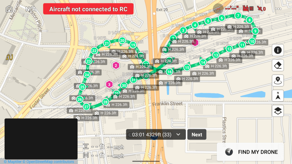
Modern drone technology enables the creation of custom flight paths during an initial site survey. These flight paths can be saved and reused on a recurring basis – whether daily, weekly, or monthly – to capture consistent visuals from the same angles. This ensures accurate comparisons over time and allows you to visualize site progression through repeatable and reliable data collection.
At Railway and Transit Solutions, your construction updates are always available via your own private, customized project page – making it easy to monitor development and keep stakeholders informed.
Still Imaging
With programmed flight paths, drones can revisit the same photo locations repeatedly, providing consistent, high-quality imagery that clearly highlights changes on-site. Whether you’re tracking progress daily, weekly, or monthly, this feature allows for quick visual comparisons and efficient project assessment.


Video Timelapse
Similar to the still imaging, drone operators can use predefined flight paths to capture consistent video footage over time. This enables the creation of time-lapse videos that effectively illustrate job site progression from identical viewpoints – ideal for stakeholder updates, internal reporting, or project documentation.
Before and After Slider
Specialized drone imaging tools allow for precise before-and-after comparisons of your job site. The slider interface makes it easy to identify key changes such as material stockpile movement, fill pile expansion, equipment relocation, and potential safety concerns. This tool delivers meaningful insights in moments, helping you evaluate site activity at a glance.